Satellite Methane Monitoring for OGMP 2.0: How Oil & Gas Teams Can Find and Fix Leaks Faster (and Prove It)
Satellite methane monitoring is quickly becoming a practical tool for oil & gas operators who need to reduce methane leaks, speed up response, and produce defensible, measurement-informed reporting aligned with OGMP 2.0 expectations.
If you’re a COO, Head of Operations, Risk Manager, VP of Asset Management, Chief Security Officer, CFO, or Trade/Compliance leader, here’s the operational reality:
Methane incidents don’t wait for business hours
The reputational narrative can outrun your internal reporting
Regulators and buyers are increasingly asking for measurement-based evidence
You need a workflow that goes from detection → repair → verification without delays
This is where satellites—and URGENT EO (UrgentEO)—help you move from “we think something happened” to “we have coordinates, proof, and a repair plan.”
OGMP 2.0 in plain language: why measurement is the new standard
OGMP 2.0 (Oil & Gas Methane Partnership 2.0) is a leading framework pushing the sector away from generic estimates and toward measurement-based methane inventories that can stand up to scrutiny.
Important clarification: OGMP 2.0 isn’t a law by itself, but it’s increasingly treated as a benchmark by investors, buyers, and regulators. The direction of travel is clear: credible methane data and fast mitigation are becoming a license to operate.
What “better reporting” really means operationally
To align with OGMP 2.0, companies typically need to show:
Clear asset boundaries (operated vs non-operated / JV assets)
Repeatable monitoring and measurement practices
A plan to improve data quality over time
A mitigation program that proves leaks were actually reduced—not just estimated differently
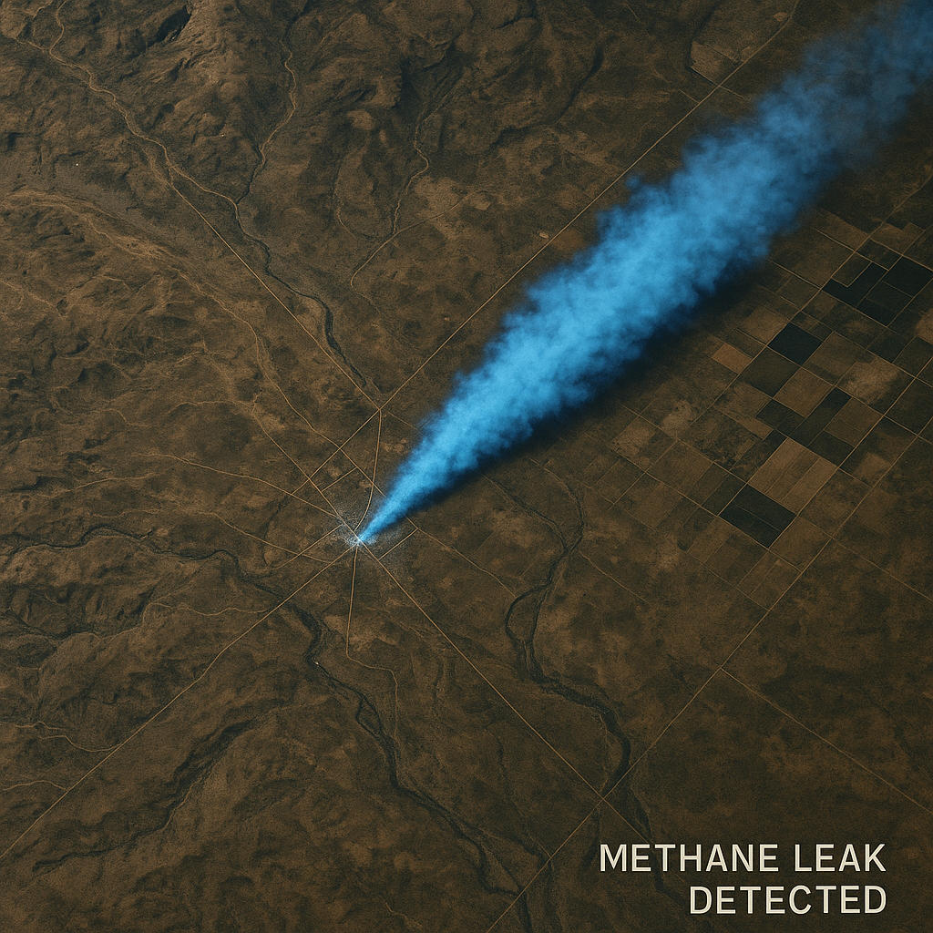
Why satellites matter for methane: speed, coverage, and independent evidence
Methane leaks are often:
Remote (pipelines, compressor stations, gathering systems)
Episodic (intermittent venting, abnormal operating conditions)
Hard to spot quickly with ground-only methods
“Invisible” until they become a major event
Satellites bring three powerful advantages:
Wide-area screening: See large regions of infrastructure without sending crews everywhere
Faster triage: Identify where to focus LDAR and maintenance teams
Independent verification: Support reconciliation and “proof of fix” after repairs
Satellites don’t replace LDAR. They help your LDAR become faster and smarter.
The “Golden Hour” problem: methane response is measured in hours, not weeks
When a leak or abnormal release happens, leadership needs answers now:
Is this real or a false alarm?
How big is the issue?
Where exactly is the source likely located?
Is it continuing or already stopped?
What’s the safest and fastest response?
Traditional procurement and slow data workflows can turn a fixable issue into:
extended emissions
longer downtime
higher compliance risk
reputation damage
This is the URGENT EO moment
URGENT EO (UrgentEO) is built for these situations: when there’s a leak, disruption, or crisis and you need Urgent Satellite Data fast—without scrambling through vendor queues when time is tight.
The satellite-to-spanner workflow: a methane playbook that actually works
A strong methane program isn’t “more data.” It’s a workflow that drives action.
Here’s a proven structure you can operationalize across assets:
1) Detect: wide-area screening triggers the incident
Detections and triggers can come from:
satellite alerts (public or partner systems)
SCADA anomalies (pressure drops, compressor trips, abnormal operations)
on-site observations
community/third-party reports
Outcome: An incident is created with a timestamp, location context, and preliminary severity.
2) Triage with GEO AI: decide what matters most, fastest
Once you have a detection, your constraint is usually response capacity.
This is where GEO AI helps you triage by combining detections with operational context:
asset footprints and facility polygons
pipeline right-of-way corridors
nearby communities and sensitive receptors
historical leak patterns and recurrence
wind, terrain, and access constraints
This triage layer should rely on areal data (facility boundaries, land parcels, exclusion zones, jurisdiction boundaries) so decisions are defensible and repeatable.
Outcome: A ranked response queue: what to check first, and why.
3) Confirm and localize with Urgent Satellite Data (fast)
Detection is the alarm bell. Now operations teams need precision.
This is where Urgent Satellite Data becomes critical:
confirm the event
narrow the likely source area
produce GIS-ready outputs for field response
deliver decision-ready intelligence quickly
Preparedness tip: Don’t wait to “set up satellites” during a crisis.
URGENT EO can help you pre-configure rapid tasking and delivery workflows now—so when a leak happens, you activate a playbook instead of improvising.
Outcome: Actionable location intelligence to guide dispatch.
4) Dispatch LDAR and maintenance: fix the leak
Once you have a prioritized target:
generate a work order in your CMMS/EHS system
dispatch LDAR (OGI camera, handheld, drone, truck-based survey—your standard stack)
repair the source and log:
what was fixed (component/process)
when it was fixed (timestamp)
who performed the repair
supporting evidence (photos, readings, reports)
Outcome: A real operational fix, not just a detection event.
5) Verify: close the loop with “proof of fix”
The fastest way to build credibility is to verify repairs.
Verification can include:
post-repair on-site checks
airborne follow-up (where appropriate)
repeat satellite observation to confirm the emissions signature has changed
This is especially important when methane programs are audited, independently verified, or challenged by external stakeholders.
Outcome: Evidence that supports OGMP 2.0-aligned reporting and stakeholder confidence.
What “analysis-ready” deliverables look like (and why your team needs them)
If your teams receive raw satellite files that take hours to process, your response slows down.
A methane response program should deliver outputs your teams can use immediately in GIS and operations platforms.
The formats that reduce friction
GeoJSON: plume polygons, likely source points, facility overlays
GeoTIFF: raster layers (heat-style surfaces, concentration enhancement maps)
Event metadata:
timestamps
confidence levels
acquisition details
processing notes for audit trail
Why GEO Archive Data matters
When reporting season hits (or an incident is investigated), you don’t want to rebuild evidence from memory.
A structured GEO Archive Data approach lets you maintain:
baseline imagery and measurements
incident detections and follow-ups
response actions and timestamps
verification evidence
a clean audit trail for internal and external review
URGENT EO is designed to help teams move from “raw imagery” to analysis-ready intelligence that’s easy to store, retrieve, and defend.
Common methane program failures (and how to avoid them)
Failure #1: Procurement bottlenecks during an incident
If approvals and vendor onboarding start after the leak, the timeline slips.
Fix: Pre-arrange a rapid activation path.
URGENT EO can help you set up a readiness plan so satellite tasking and delivery don’t get stuck in procurement loops.
Failure #2: Single-sensor dependency
Clouds, night, or coverage gaps can delay confirmations.
Fix: Use a sensor-agnostic approach where the goal is the outcome, not a single provider.
Failure #3: Data that isn’t operational
If the output isn’t GIS-ready and aligned to workflows, it won’t drive repairs.
Fix: Standardize deliverables (GeoJSON + GeoTIFF + metadata) and integrate them into CMMS/EHS workflows.
Failure #4: No verification loop
Without verification, you can’t confidently claim reductions.
Fix: Build “verify” into your playbook as a required step, not an optional one.
A crisis-ready checklist (copy this into your ops runbook)
Before the leak (preparedness)
Map all priority assets and define boundaries (operated vs non-operated)
Confirm your areal data layers are current (facility footprints, ROWs, buffers)
Define incident triggers and escalation contacts
Establish response SLAs (detect → triage → dispatch → verify)
Set standard data outputs (GeoJSON/GeoTIFF + metadata)
Create a GEO Archive Data repository for evidence and audit trails
Set up URGENT EO now so urgent tasking is ready when you need it
During the leak (response)
Create an incident record and timestamp it
Triage with GEO AI to prioritize response
Activate Urgent Satellite Data for confirmation/localization
Dispatch LDAR/maintenance with coordinates and safety context
Log repair actions and attach evidence
After the leak (proof + reporting)
Verify post-repair outcomes
Package “before/after” evidence
Update internal inventories and lessons learned
Feed results into OGMP 2.0-aligned reporting workflows
FAQ: quick answers leadership teams ask
Do satellites replace LDAR?
No. Satellites help you find and prioritize issues faster and support verification, but LDAR and maintenance crews still do the repair work.
Are satellites only useful for huge “super-emitter” events?
They are especially strong for large events and wide-area screening, but they’re also useful as a persistent oversight layer that reduces blind spots between on-site campaigns.
What’s the fastest way to start?
Start with preparedness:
map assets
define triggers
standardize deliverables
build the response workflow
set up URGENT EO so you can activate urgent tasking immediately
Conclusion: Don’t wait for a leak to discover your data pipeline is slow
OGMP 2.0 expectations and methane-focused oversight are pushing the industry toward credible measurement, rapid mitigation, and verification-ready evidence.
Satellites help you:
detect methane events across large footprints
reduce time-to-repair
prioritize the highest-impact issues
prove mitigation worked through follow-up verification
But the biggest advantage is gained before the incident happens.
Get in touch with URGENT EO now so you’re prepared.
When the moment arises—a leak, outage, or crisis—you’ll already have a rapid-response Urgent Satellite Data playbook in place, supported by GEO AI, GIS-ready outputs, and a defensible GEO Archive Data trail.
Prepared teams don’t scramble—they respond.
Crisis-Ready Satellites: The Strengths and Weaknesses of Your Orbital Toolbox
When a refinery explodes, a port shuts down, or a wildfire jumps a highway, you don’t have days—you have minutes. In those minutes, Urgent Satellite Data can turn guesswork into an operational decision. But not all satellites see the crisis the same way.
For COOs, heads of operations, risk managers and CSOs, here’s a fast, practical guide to the main satellite types that deliver insight in the heat of the moment—and where each one breaks.
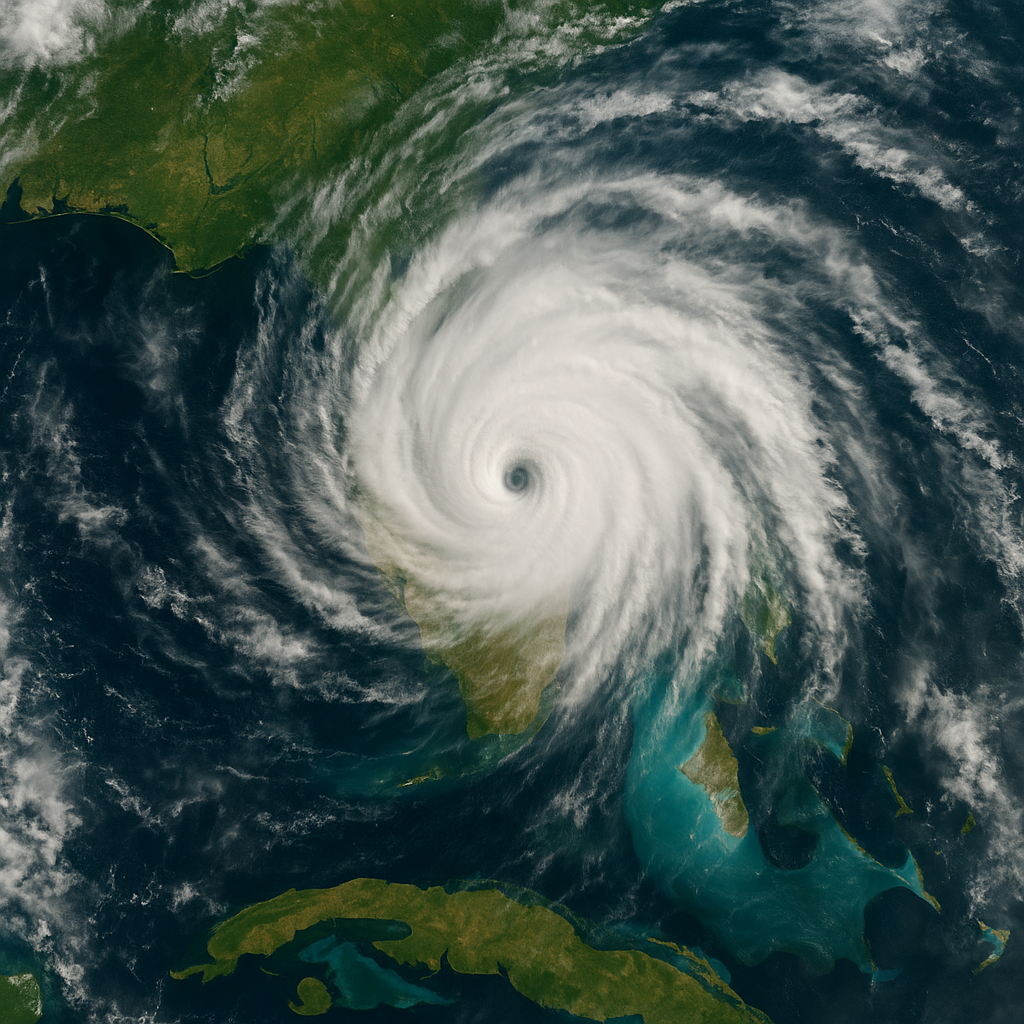
1. Optical Imaging Satellites: “What It Looks Like”
Think of these as high‑resolution cameras in orbit.
Strengths
Intuitive, map‑ready images anyone on your exec team can read
Very high spatial resolution (down to sub‑meter)
Ideal for visible damage: collapsed buildings, washed‑out roads, burned areas
Weaknesses
Blind under heavy cloud, smoke, or ash
Daylight only—no night coverage
Struggles with subtle or internal damage
Best for: Clear‑sky damage assessment, media‑facing visuals, compliance documentation based on areal data snapshots.
2. Radar (SAR) Satellites: “See Through the Storm”
Synthetic Aperture Radar (SAR) sends its own microwave signal and measures the echo, so it doesn’t care about sunlight and barely cares about weather.
Strengths
All‑weather, day–night coverage
Excellent for floods, oil spills and ground deformation (landslides, tailings dams, subsidence)
Very strong for change detection when you have pre‑event images
Weaknesses
Images look noisy and abstract to non‑experts
Distortions in mountainous or dense urban areas
Typically lower native resolution than top optical systems
Best for: Flood mapping under cloud, monitoring dams and pipelines, detecting hidden activity in bad weather.
3. Thermal Infrared Satellites: “Where Is It Hot?”
Thermal sensors measure heat, not reflected light.
Strengths
Detects wildfire fronts, gas flares, overheating transformers and industrial hotspots—even at night
Sees through darkness and some smoke or haze
Great for prioritizing where to send limited crews across a big incident area
Weaknesses
Coarser resolution; small assets can blur together
Revisit times can be limiting without a constellation
Often needs drones or aircraft to zoom in after detection
Best for: Wildfire detection and tracking, monitoring critical infrastructure heat signatures, spotting leaks or burns before humans notice.
4. High‑Revisit SmallSat Constellations: “Always‑On Context”
Dozens or hundreds of small satellites trade sharpness for frequency. They give you a live timeline, not just a postcard.
Strengths
Multiple passes per day over the same asset or corridor
Perfect for pattern‑of‑life, port congestion and supply‑chain visibility
Fuel GEO AI models that need dense time series to predict risk, not just describe it
Weaknesses
Lower resolution per scene than flagship satellites
Data overload without automation—no human can check it all
Quality and calibration vary across providers
Best for: Monitoring evolving events (prolonged floods, congested ports, slow‑moving conflicts) and training GEO AI that turns raw areal data into operational alerts.
5. Why the Smart Move Is “All of the Above”
There is no single “best” satellite type in a crisis. Each has a different failure mode:
Optical fails in cloud and smoke
SAR is powerful but harder to interpret
Thermal is great for heat but not fine detail
Constellations trade image sharpness for speed and cadence
Modern crisis management fuses them:
SAR for guaranteed coverage and change detection
Optical for human‑readable confirmation and storytelling
Thermal for fires and heat anomalies
Constellations for early warning and trend detection
This is exactly where UrgentEO comes in: we orchestrate multi‑sensor, multi‑vendor Urgent Satellite Data, apply GEO AI, and deliver one clear answer to leadership—“Is the asset safe, compromised, or failing?” UrgentEO handles your enterprise’s crisis readiness end‑to‑end, so your team doesn’t need to become satellite experts overnight.
Conclusion & Call to Action: Turn Space Into a Crisis Asset
If you’re responsible for operations, security, or risk, your crisis plan should specify which satellite types you rely on for which questions—and who you call in the first hour.
UrgentEO (URGENT EO) is that call. We design your orbital playbook, handle tasking across radar, optical, thermal and constellation providers, and convert complex space data into simple, time‑critical decisions.
👉 To evaluate your current crisis readiness and build a satellite‑backed response plan tailored to your assets, get in touch with URGENT EO today and let us turn orbital chaos into operational clarity.
Why UrgentEO Was Created: Ending the Costly Silence in Critical Operations
It all begins with an idea.
When a pipeline ruptures, a port shuts down, or civil unrest erupts near a key facility, COOs, heads of operations, risk managers, CSOs and CFOs don’t have days to react — they have minutes. UrgentEO was created to solve one brutal truth: traditional satellite data moves too slowly for modern risk.
The Problem: Crises Move in Minutes, Satellites in Weeks
Before UrgentEO, enterprise teams needing satellite insight faced:
Slow vendor negotiations and “office hours” email chains
Single-satellite dependencies and weather/coverage gaps
Raw imagery dumps that required hours or days of in-house processing
Meanwhile, every minute of downtime could cost thousands, and unmanaged incidents could snowball into environmental damage, safety failures, and reputational crises.
The Gap UrgentEO Exists to Close
UrgentEO was built as the “Red Phone” for orbital intelligence — a fiduciary Orbital Operations Center that:
Instantly tasks Urgent Satellite Data from multiple constellations
Uses radar, optical, and thermal sensors to cut through clouds, night, and chaos
Delivers analysis-ready intelligence, not just pretty pictures
Instead of buying pixels, leaders get answers: Is the asset intact? Where is the flood line? Do we evacuate or stay put?
GEO AI + Areal Data, Built for Decisions
By combining GEO AI with curated areal data, UrgentEO translates complex satellite streams into:
Clean geotiffs, geoJSON and vector products
Simple “Go / No-Go” dashboards
Evidence you can defend to boards, regulators, and insurers
From Guessing to Ground Truth
Why UrgentEO Was Created: Ending the Costly Silence in Critical Operations
When a pipeline ruptures, a port shuts down, or civil unrest erupts near a key facility, COOs, heads of operations, risk managers, CSOs and CFOs don’t have days to react — they have minutes. UrgentEO was created to solve one brutal truth: traditional satellite data moves too slowly for modern risk.
The Problem: Crises Move in Minutes, Satellites in Weeks
Before UrgentEO, enterprise teams needing satellite insight faced:
Slow vendor negotiations and “office hours” email chains
Single-satellite dependencies and weather/coverage gaps
Raw imagery dumps that required hours or days of in-house processing
Meanwhile, every minute of downtime could cost thousands, and unmanaged incidents could snowball into environmental damage, safety failures, and reputational crises.
The Gap UrgentEO Exists to Close
UrgentEO was built as the “Red Phone” for orbital intelligence — a fiduciary Orbital Operations Center that:
Instantly tasks Urgent Satellite Data from multiple constellations
Uses radar, optical, and thermal sensors to cut through clouds, night, and chaos
Delivers analysis-ready intelligence, not just pretty pictures
Instead of buying pixels, leaders get answers: Is the asset intact? Where is the flood line? Do we evacuate or stay put?
GEO AI + Areal Data, Built for Decisions
By combining GEO AI with curated areal data, UrgentEO translates complex satellite streams into:
Clean geotiffs, geoJSON and vector products
Simple “Go / No-Go” dashboards
Evidence you can defend to boards, regulators, and insurers
From Guessing to Ground Truth
UrgentEO was created so your organization never has to make million‑dollar decisions in an information vacuum again.